Re-wetting measures
The planned rewetting measures will serve to prevent permanent water runoff from the four bogs. Rain water retention on the bogs is to be improved in future so as to achieve water saturation of the peat body throughout the year, if possible. The planned hydraulic engineering works are mutually dependent and, combined, will lead to the desired re-wetting effect. The detailed planning now pending and the approval procedures subsequently necessary where water legislation is concerned are the next steps to be taken prior to implementation of the measures.
- Construction of moorland peat banks
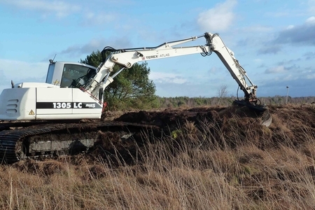
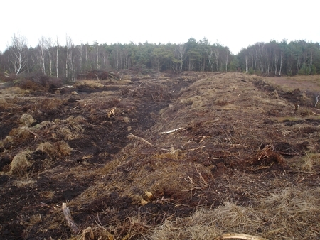
At suitable locations on the bog, water runoff is to be prevented by means of machine-built peat banks. A first construction design exists in this regard which depicts the rough location of the peat banks and of the poldered areas that are to form as a result. The objective is to establish a water level in the polders that is as near to the surface as possible. Major flooding of vegetation worthy of protection is to be avoided. All near-surface runoff points will also be removed when the peat banks are constructed.
- Filling-in of drainage ditches
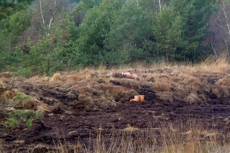
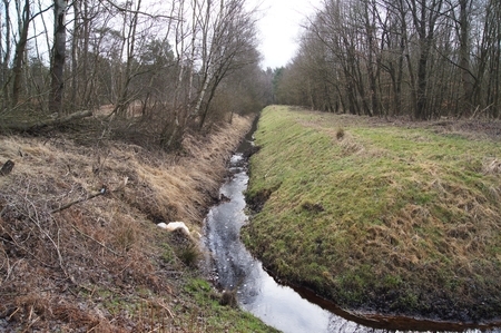
Numerous and, in some cases, very deeply cut drainage ditches currently discharge water from the bogs. This is to be discontinued by filling-in these ditches. The ditches in question will be filled in either completely or over larger distances. Mineral soil with a low water permeability will primarily be used for filling-in. Any compartmentalisations will be filled-in on a case-by-case basis. The filling-in work will extend over a minimum length of 5 metres. The distance between fillings will be tailored to the terrain slope. Ditches and ditch structures without any currently discernible drainage function and the (former) ditch sections lying in future between the filled locations will be left to their own dynamic development without any additional treatment. - Filling-in of the receiving water body
The “Kaltenweider Moor” receiving water body is to be partly filled-in in the project area. It is a channel-like drainage ditch with a depth of 2.5 to 3 metres and runs along the southern edge of Bissendorfer Moor. Because of its cut depth its drainage effect is considerable and is therefore to be rendered hydraulically ineffective. The intention is to compartmentalise the receiving water body over a width of some 5 metres approximately every 200 metres. In the vicinity of the receiving water body there are various smaller ditches which, in return, will be extended slightly in order to drain excess water from the adjacent land. For this reason it is also necessary to build individual new ditches.
- Installation of ground sills in drainage ditches
To raise the water level there are plans to reduce the hydraulic effectiveness in sections of several ditches on the bog fringes. This will involve installing ground sills at intervals of around 200 metres, which will raise the ditch water levels by some 0.20 metres. These ditches on the periphery of the project area cannot be filled-in completely because adjacent land lying outside the project area must not be adversely affected by water level increases. - Installation of adjustable weir mechanisms in drainage ditches
Three adjustable weir mechanisms are to be installed in ditches located on the bog fringes. This will make it possible to optimally manage target water levels for the re-wetting of the bogs and adjoining land areas. The water level in the ditches concerned will be raised by 0.3 to 0.5 metres compared with the current state. - Development and new construction of water bodies outside re-wetting areas
The moorland in the project area that is to become wetter as a result of these measures will in future be less able to absorb large amounts of precipitation on account of higher water saturation. For this reason a higher water runoff from the project area has to be expected during heavy rainfall events. To be able to handle this water runoff, some ditch sections need to be developed or newly constructed. This will preclude adjoining land areas from being affected. The ditch sections will be developed or newly constructed to have a typical trapezoidal profile as a function of the hydraulic demands.

Artikel-Informationen
Ansprechpartner/in:
Susanne Brosch
Nds. Landesbetrieb für Wasserwirtschaft, Küsten- und Naturschutz
Betriebsstelle Hannover-Hildesheim
- Projektleitung Life+ Moorgeest
Göttinger Chaussee 76 A
D-30453 Hannover
Tel: +49 (0)511 / 3034-3115


