


Otternhagener Moor
Otternhagener Moor lies in the west of the “Hannoversche Moorgeest” peat bogs and is the largest raised bog in the project area, covering some 974 hectares. It is a relatively near-natural raised bog and characterised by open marshland areas and moor vegetation made up of erica (Erica tetralix), cotton grass (Eriophorum) communities, and peat moss (Sphagnum). Nutrient-poor stagnant water bodies and numerous smaller bodies of water are typical of the area. Placed under protection as a nature reserve in 1970, Otternhagener Moor forms part of the Helstorfer, Otternhagener and Schwarzes Moor Fauna-Flora-Habitat (FFH) area
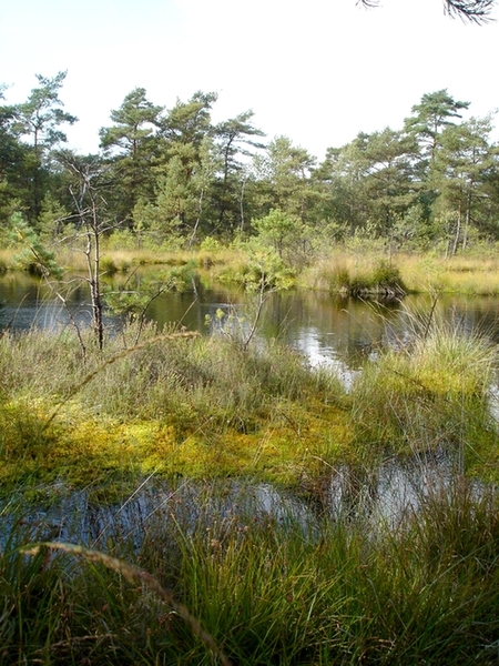
Large marshland pond in the southern part of Otternhagener Moor (picture taken by S. Brosch)
Otternhagener Moor started to take shape some 3,000 years ago in a shallow, northwest-sloping depression between deposits from the Saale Ice Age. A layer of sedge (Carex) -rich birch carr peat was followed by fibric peat. The fibric peat layer is up to 4 metres thick in its core areas. In some places there is a layer of sapric peat with a thickness of about 1 metre. The layers at the fringes are less substantial, and the marshland areas outside the present-day moor have been so superprinted by drainage and other cultivation measures that there are “sand-mix cultivations” in the northwest and northeast and sodden medium podsol-gley soils in the west.
Otternhagener Moor was drained via a system of branch ditches toward larger outlying ditches, with the water in the north being conducted to the “Neue Auter” brook and, in the south and west to the “Auter” brook. In the summer, however, the ditches dry out to such an extent that surface runoff is then no longer discernible.
There are, also, a number of marshland ponds on Otternhagener Moor that have come about from former joined-together peat-cutting sites. There, too, open bodies of water all but disappear in the summer months.
Farmers used to cut peat manually over a large area on Otternhagener Moor, thus affecting nearly the entire bog and creating a landscape dominated by bog woodland and carr vegetation.
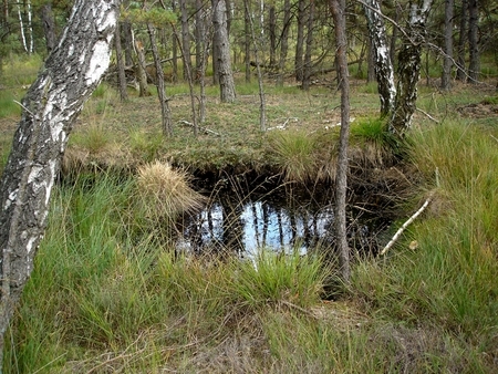
Former manual peat cutting site in bog woodland (picture taken by S. Brosch)
The former peat cutting sites are in different stages of development and regeneration. The open bodies of water are bordered by peat moss (Sphagnum) as well as standing and lying deadwood. Added to this there are extensive quaking peak moss mats from which hummocks covered with dwarf shrubs protrude, and former extraction ditches where heather (Calluna vulgaris) and purple moor grass (Molinia caerulea) grow.
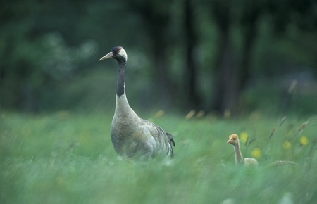
Crane (Grus grus) with chick (picture taken by D. Damschen)
Artikel-Informationen
Ansprechpartner/in:
Susanne Brosch
Nds. Landesbetrieb für Wasserwirtschaft, Küsten- und Naturschutz
Betriebsstelle Hannover-Hildesheim
- Projektleitung Life+ Moorgeest
Göttinger Chaussee 76 A
D-30453 Hannover
Tel: +49 (0)511 / 3034-3115