


 Bildrechte: NLWKN
Usage History of the Project Area
The so-called "Wurster Höhenrücken", a ridge where the project area is located, would normally have extensive forests. Here in the coastal area with its ice-age sandy soil there were mixed forests of predominantly beech and oak trees. In especially dry and oligotrophic locations there were probably also oak, birch and pine forests interspersed with heath areas.
Human use completely changed these forests and in medieval times they had been entirely destroyed. The maps of the Hannover geodesic survey of 1770 as well as maps created in 1870 show a continuous stretch of forest-free heath from the village of Debstedt to the village of Sahlenburg.
Only from 1880 onwards, after common land was abolished, did reforestation become possible. Charles A. Werner started this work in the area that is today known as "Wernerwald", located in the northwest of the project area.
Since the turn of the century around 1900, today's project area became a military training ground:
| 1913/14 | The navy shooting range Altenwalde was established |
| 1940 | Parts of the Wernerwald were bought An ammunition bunker was built in the southern area Anti-ship V-missiles were tested Air defence facilities and search light towers were built Shooting range "Raketenschneise" (rocket corridor) in Wernerwald |
| 1955 | Deployment of the tank forces after establishment of the German armed forces (Bundeswehr) |
| 1972 | Land swaps between the federal country of Lower Saxony and the German federal authorities establish the largest part of today's property boundaries |
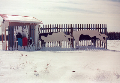 Bildrechte: Bundeswehr Altenwalde
"Cattle on the range" during the time of the Bundeswehr
While the project area was used as a military training ground, 4 phases of reforestation took place:
| 1913/14 | Predominantly black pine in the area where the barracks are located today |
| 1935-1940 | Black pine in the area of the Oxstedt depot |
| 1951-1957 | Black pine in the area of Berensche Heide (with several clusters of oak trees) |
| ab 1968 | Japanese larch, silver spruce and black alder after purchase of heath areas in the northern part of the project area along the rampart called the "Burgwall" and as strategic groves in the open spaces |
For the edges of the forest and as protection against forest fires the black cherry tree was introduced, which originally stems from North America. Since the 1970s more and more deciduous trees have been planted between the coniferous trees, the objective being to develop deciduous mixed forests suited to the location.
Until the 1960s parts of the project area were also used for agricultural purposes, for example the so-called "Rehwiese" (deer meadow) in the southwest of the area. This is reflected in the vegetation until today.
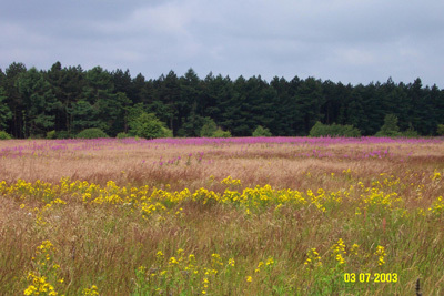 Bildrechte: Bundeswehr Altenwalde
Semi-ruderal fields of grass and bushes with St. John's wort and willow-herb in the area of the so-called "Rehwiese" (deer meadow), on former agricultural land
The type of use by the military was defined in the plan for land use, which was set up by the military in co-operation with the location management and the federal forestry authority, and in a way constituted the "internal land use planning" of the federal authorities.
The maintenance plan, which was developed from the plan for land use, defined which measures would be taken. These included:
- Regular mowing of heath areas
- Mechanical removal of black cherry trees
- Fires on the shooting ranges to be put out by the fire brigade
- Zoning of quiet areas where digging of trenches and driving was forbidden
- Permanent marking of bivouac areas
- Blocking off protected habitat areas from military activities where necessary
The regular military activity in the training ground largely secured the development of the existing habitat structures. Other intensive human uses were barred. Entering the grounds was forbidden, therefore the public did not have access.
At the end of 2003 the military use of the training ground was ceased. This meant that the maintenance of the valuable heath and lean turf, which was ensured through the military training activities and the maintenance plan, was no longer given.
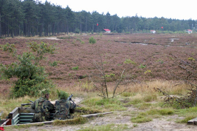 Bildrechte: Bundeswehr Altenwalde
For their training acitivies the troops needed a free field of vision for shooting. For this reason upcoming shrubs were regularly removed.
Bildrechte: NLWKNLinks to further information about
- LIFE Nature Project
- Project Sponsors and Financing
- Project Goals
- Project Organisation
- Location and Size
- Usage History
- Geology and Soils
- Biotope and Habitat Types
- Animal and Plant Species
- Project of National Significance
- Natura 2000, Nature Reserve
- Heck Cattle and Konik Horse Grazing
- Wisent Grazing
- Small Ponds
- Development of Forests Suited to the Location
- Removal of Small Trees and Shrubs
- Information for Visitors
Artikel-Informationen
Ansprechpartner/in:
Hannah Burmester
Nds. Landesbetrieb für Wasserwirtschaft, Küsten- und Naturschutz
Betriebsstelle Lüneburg
Adolph-Kolping-Str. 6
D-21337 Lüneburg
Tel: +49 (0)4131 2209-221